
Rolling Meadows ZIP Coverage
Official city and local sources consistently use one working ZIP for incorporated Rolling Meadows addresses. The research did not confirm a second USPS ZIP serving an incorporated city street. That makes the coverage table short, but not simple: USPS delivery geography can extend beyond municipal limits, and every edge address needs an individual postal and parcel check.
| ZIP | Area represented | Postal check | Boundary note |
|---|---|---|---|
| 60008 | Rolling Meadows city addresses and nearby delivery area using the Rolling Meadows mailing city | USPS address lookup | Postal coverage is not the incorporated city line |
The Rolling Meadows ZIP code directory should not turn 60008 into a resident or population count. ZIPs organize mail delivery. Census, election, and city figures use their own dated boundaries. The safe claim is narrower: 60008 is the confirmed working postal code, while the exact status of a property comes from municipal and county geography.
Verify Rolling Meadows ZIP Addresses
The USPS ZIP Code Lookup is the authority for the mailing string. Search the complete street address, not just a city name. This matters at an unincorporated edge, where a Rolling Meadows postal label may not prove that City Hall governs the parcel.
The manifest image shows the official USPS lookup entry point used for the Rolling Meadows ZIP code directory. It verifies mail delivery data, but it does not show parcel ownership, city jurisdiction, or a list of residents.
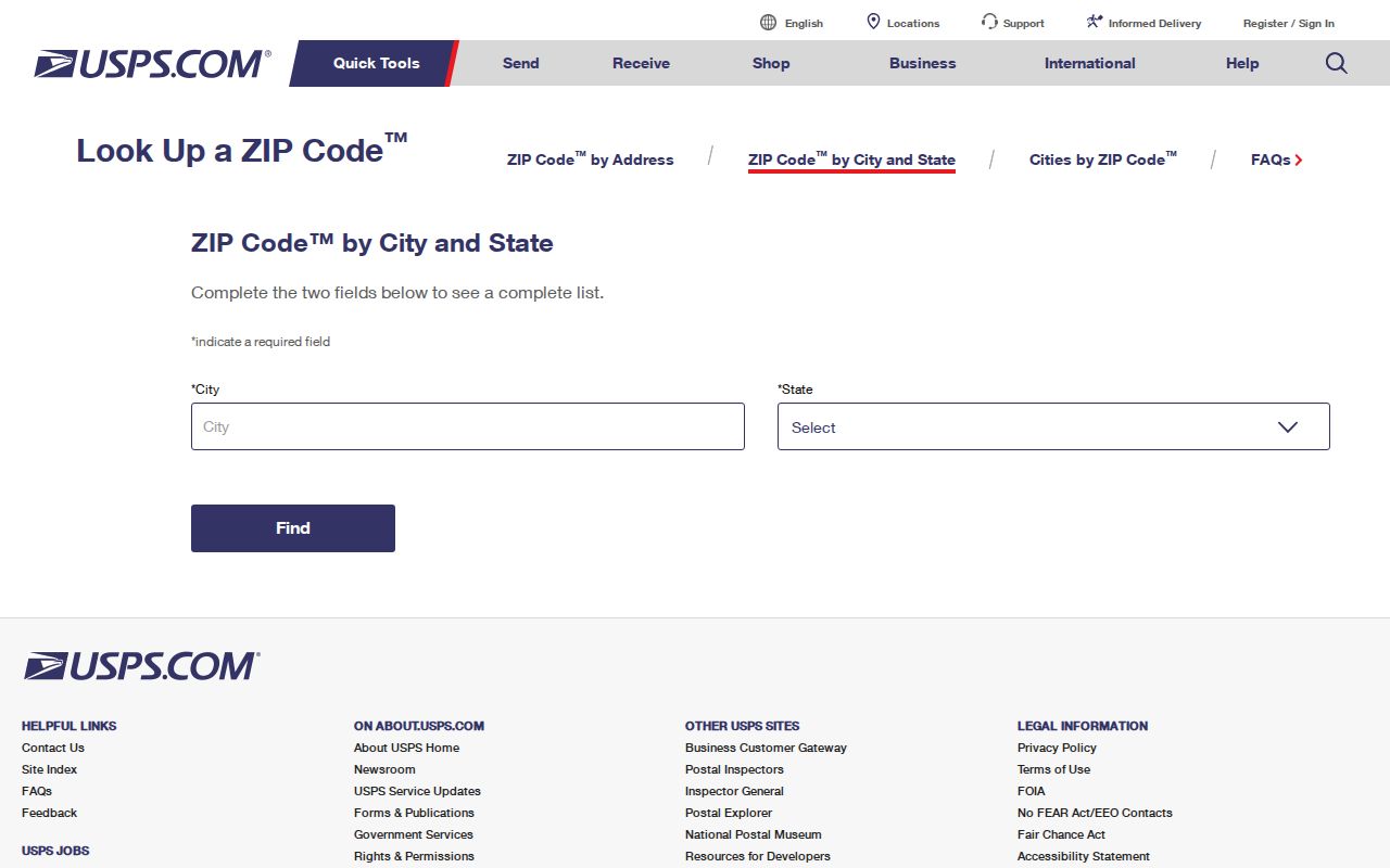
After USPS confirms the address, enter that same text in CookViewer. Compare its municipality field and parcel outline with the postal city. For a boundary property, consult the Rolling Meadows municipal GIS or Community Portal as well. Those three checks answer three distinct questions: where mail goes, which parcel is involved, and whether the address is inside city limits.
Find Rolling Meadows Records by ZIP
A postal code narrows the address, then an official portal supplies the record key. The Illinois voter lookup requires a five-digit ZIP before it presents street fields. Cook County's address-based election tool combines ZIP with a house number and street. The property tax portal can take ZIP as an optional property-address field. CookViewer accepts a full address but is not a ZIP-wide people search.
- Validate the full mailing address and 60008 through USPS.
- Use CookViewer to obtain the parcel PIN, municipality, township, and exact situs address.
- Choose the proper record tool: voter confirmation, property tax, assessor, or recorded-document index.
- Move from ZIP to street or PIN, then verify dates and roles in the source record.
Once a ZIP search has narrowed the place, the Rolling Meadows Street Directory explains the address-level record chain. Do not keep broadening a ZIP query in hopes of producing a household list. No official ZIP-wide resident roster was located.
Use 60008 in Voter Lookup
The Illinois Online Voter Registration Lookup confirms one registration through first name, last name, birth date, and five-digit ZIP. Once the ZIP passes validation, the form asks for street number and street name. It does not return every voter in 60008. Registration may also lag a move, and protected records may be withheld.
| Field | Required | Format or role |
|---|---|---|
| First Name | Yes | Name as registered |
| Last Name | Yes | Name as registered |
| Birth Date | Yes | MM-DD-YYYY |
| Five Digit Zipcode | Yes | Exactly five digits |
| Street Number and Name | After ZIP step | Dynamic address match |
Cook County's Your Voter Information tool uses house number, optional direction, street, optional street type, ZIP, and an optional last name. It can show address-linked polling, ballot, early-voting, and elected-official modules. Under Illinois election law, these services are for confirmation and civic information, not for scraping a postal directory of households.
Rolling Meadows ZIP to Parcel
The Cook County Assessor's inspected public address form is not an owner-name or ZIP-wide directory. It searches a 14-digit PIN, street address, township, neighborhood, class, and related address criteria. The property tax portal offers an optional ZIP in its address search, while CookViewer works best with a complete address or PIN.
A parcel search separates three address ideas that often look alike. The situs address is the physical location. A tax-bill mailing address is where notices go and may differ from the site. A deed may identify land by lot, block, subdivision, or another legal description. A postal directory cannot collapse those strings into one resident identity.
Best record key. Carry the CookViewer PIN into the tax and Clerk recording systems; it is more exact than a ZIP or street name.
The Clerk's Recordings System then lets a researcher connect the parcel key with indexed instruments and named grantors or grantees. A grantor transfers an interest; a grantee receives it. Neither term means that the party lived at the Rolling Meadows address. Online index access is free, while images and certified copies may have separate access or cost.
Palatine Township in 60008
CookViewer commonly places a Rolling Meadows mailing address in Palatine Township. This is a tax-geography label, not a statement that the address is in the Village of Palatine. Parcel examples researched at 1 Applejack Road and 2815 Kirchoff Road show how Rolling Meadows municipality and 60008 mailing data can coexist with Palatine Township.
This geographic overlap is one of the most useful local search clues. Older sources may file a place under Rolling Meadows, Palatine Township, Chicago Suburban, or a telephone exchange. Current records may divide responsibility among the city, township, county, and postal service. Preserve each label with its date rather than replacing it with one modern place name.
The same caution applies near unincorporated land identified in city planning materials. A postal result alone cannot assign the municipal custodian for permits or code files. Check CookViewer's municipality field, the parcel map, and Rolling Meadows GIS before sending an Illinois Freedom of Information Act request.
Rolling Meadows ZIP History Clues
Rolling Meadows grew as a planned postwar suburb and incorporated in 1955. City materials describe about 700 homes and 5,162 residents that year, compared with a 2020 Census population of 24,200 across about 5.64 square miles. Those figures describe city growth, not the number of people in ZIP 60008.
Subdivision names can help place an old address within that growth. Kimball Hill, Creekside, Tall Oaks, and Dawngate appear in local history or planning sources. Creekside's public history dates its 109-home development to 1968 through 1972. The 2018 Comprehensive Plan also organizes subareas around Kirchoff, Golf, Northwest Industrial, and Algonquin. A newspaper, plat, or directory may use one of those labels when a ZIP-only search finds nothing.
Preserve the old label and year. A 1955 telephone directory may use Chicago Suburban or exchange names such as WInfld and CLearbrk. Those terms are date clues, not current street or ZIP identifiers. Pair them with parcel history, directory pages, and dated maps before drawing a conclusion.
Rolling Meadows ZIP Boundary Limits
A ZIP is a mail-delivery zone, while city limits define municipal jurisdiction. A tax township organizes assessments, and a parcel boundary defines land. They may overlap, but they are not interchangeable. That is why the Rolling Meadows ZIP code directory uses USPS for mail, CookViewer for parcels, and municipal GIS for incorporation.
- ZIP and ZIP+4
- A five-digit delivery area and a more precise four-digit add-on for a delivery segment.
- PO-box ZIP
- A code or segment serving post-office boxes rather than ordinary street delivery.
- Unique ZIP
- A code assigned to one large organization; none was confirmed for incorporated Rolling Meadows.
- Carrier route
- A postal delivery path within a ZIP, not a legal neighborhood or city boundary.
No second incorporated-city ZIP, PO-box-only Rolling Meadows ZIP, or unique ZIP was confirmed in the official sources inspected. That absence should not be filled with nearby codes or guessed boundaries. Verify each edge address through USPS and then check its city and parcel status.
What 60008 Cannot Reveal
Neither 60008 nor any official property tool reveals everyone living within the delivery area. A parcel result may show assessments and districts without a person. A voter check confirms one supplied identity under election rules. Tax mailing data can point somewhere other than the situs address. Protected residents may use substitute or withheld address information.
Use the postal directory for lawful place research, family history, civic checks, and parcel context. Record the search date because postal and municipal boundaries can change. Do not publish private identifiers or infer a household from a shared postal code. If a record conflicts with the mailing address, keep the source date and ask its official custodian to explain or correct the entry.